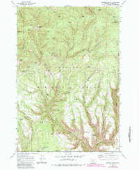
1969 Map of Madison Butte
USGS Topo · Published 1984About this map
Madison Butte and its surrounding peaks define this portion of the Umatilla National Forest in Morrow County, where rugged ridge systems and numerous natural springs shaped early land use. The presence of the Morphine Ranch (Site) near Morphine Ridge suggests a legacy of homesteading or cattle ranching in the high country, while the Tupper Guard Sta reflects the administrative presence of the Forest Service in managing these timberlands.
Find a feature on this map
58 named features on this map. Tap any name to fly to it.
Don’t see what you’re looking for? This feature index may not catch every label — zoom into the map to look around manually.
Map Details
Editions of this 1969 Madison Butte Map
2 editions found
Other maps of this area

1951 · Monument
USGS Topo · 1:62,500

1953 · Kimberly
USGS Topo · 1:62,500

1953 · Pendleton
USGS Topo · 1:250,000

1955 · Canyon City
USGS Topo · 1:250,000

1956 · Pendleton
USGS Topo · 1:250,000

1959 · Canyon City
USGS Topo · 1:250,000

1969 · Summerfield Ridge
USGS Topo · 1:24,000

1969 · Lake Penland
USGS Topo · 1:24,000

1969 · Arbuckle Mtn
USGS Topo · 1:24,000

1969 · Madison Butte
USGS Topo · 1:24,000