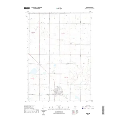
2019 Map of Madison
USGS Topo · Published 2019About this map
Madison serves as the central hub of this agricultural landscape in Lac qui Parle County, where a precise grid of rural roads and section lines defines the prairie. The town's street plan is clearly visible, from 11th St down to 1st St, indicating a concentrated residential and commercial core surrounded by expansive farmland. Outside the city limits, the terrain is dotted with small wetlands and intermittent water bodies, reflecting the glacial heritage of the region. Local heritage and community landmarks are anchored by sites such as Hegre Cem to the north and Faith Cem situated just east of the main settlement. Major transit corridors like CO Hwy 59 and CO Hwy 19 bisect the townships of t119n r44w and t118n r44w, illustrating the modern connectivity of this enduring farming district.
Find a feature on this map
58 named features on this map. Tap any name to fly to it.
Don’t see what you’re looking for? This feature index may not catch every label — zoom into the map to look around manually.
Map Details
Editions of this 2019 Madison Map
This is the sole edition of this map. No revisions or reprints were ever made.
Other maps of this area

1953 · Bellingham
USGS Topo · 1:62,500

1953 · Milbank
USGS Topo · 1:250,000

1953 · Watertown
USGS Topo · 1:250,000

1958 · Milbank
USGS Topo · 1:250,000

1958 · Watertown
USGS Topo · 1:250,000

1958 · Cerro Gordo
USGS Topo · 1:24,000

1958 · Madison
USGS Topo · 1:24,000

1958 · Correll
USGS Topo · 1:24,000

1958 · Appleton
USGS Topo · 1:24,000
1967 · Dawson
USGS Topo · 1:24,000