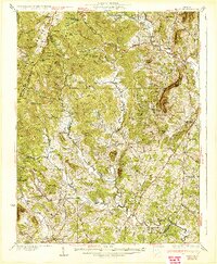
1933 Map of Madison
USGS Topo · Published 1933About this map
The Presidents Camp sits along the Mill Prong in the high mountains of the Blue Ridge, serving as a prominent landmark in this 1933 survey. The landscape is defined by a dense network of mountain missions and rural social centers, including the Lower Pocosin Mission, Upper Pocosin Mission, and Cecil Mission. These institutions, alongside schools like Berry Mtn Sch and Swift Run Sch, provided essential services to the isolated hollows and ridges of the Greene and Madison county lines.
Find a feature on this map
89 named features on this map. Tap any name to fly to it.
Don’t see what you’re looking for? This feature index may not catch every label — zoom into the map to look around manually.
Map Details
Editions of this 1933 Madison Map
3 editions found
Other maps of this area

1892 · Woodstock
USGS Topo · 1:125,000

1892 · Gordonsville
USGS Topo · 1:125,000

1892 · Harrisonburg
USGS Topo · 1:125,000

1893 · Luray
USGS Topo · 1:125,000

1905 · Luray
USGS Topo · 1:125,000

1929 · Stony Man
USGS Topo · 1:48,000

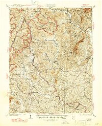
1930 · Madison
USGS Topo · 1:48,000

1931 · University
USGS Topo · 1:62,500

1933 · Stony Man
USGS Topo · 1:62,500

1933 · Madison
USGS Topo · 1:62,500