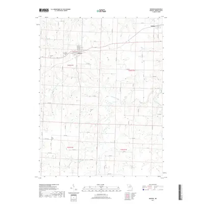
2017 Map of Madison
USGS Topo · Published 2017About this map
Madison serves as a central hub for this portion of Monroe County, situated where W Marion St and N Jefferson St meet in a traditional small-town grid. The surrounding countryside is defined by the winding course of the Elk Fork Salt River and its many tributaries, including Pedee Br and Allen Cr. This landscape is dotted with several family and community burial grounds, such as Sunset Hill Cem just west of the main settlement and the more secluded Swindell Cem and Old Prairie Cem. To the northeast, the village of Holliday sits near the junction of State Hwy A and Co Rd 116, marking a distinct secondary node of activity in an otherwise agricultural expanse. The drainage patterns of Brice Cr and Bear Br illustrate the intricate creek systems that shaped local land use and property boundaries in the early 21st century.
Find a feature on this map
73 named features on this map. Tap any name to fly to it.
Don’t see what you’re looking for? This feature index may not catch every label — zoom into the map to look around manually.
Map Details
Editions of this 2017 Madison Map
This is the sole edition of this map. No revisions or reprints were ever made.
Other maps of this area

1890 · Moberly
USGS Topo · 1:125,000

1908 · Macon
USGS Topo · 1:62,500

1910 · Macon
USGS Topo · 1:62,500

1952 · Middle Grove
USGS Topo · 1:24,000

1953 · Moberly
USGS Topo · 1:250,000

1953 · Clark
USGS Topo · 1:24,000

1954 · Moberly
USGS Topo · 1:250,000

1957 · Moberly
USGS Topo · 1:250,000

1958 · Tulip
USGS Topo · 1:24,000
1959 · Woodlawn
USGS Topo · 1:24,000