2021 Map of Madison
USGS Topo · Published 2021About this map
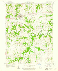
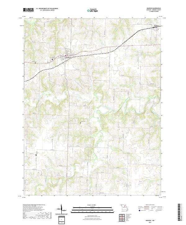
Madison and the nearby village of Holliday anchor this Monroe County landscape, where the street grid of Madison centers on North St and Broadway St. The terrain is defined by the winding course of the Elk Fork Salt River and its numerous tributaries, including Pedee Br and Allen Cr, which carve a detailed drainage network across the region. Several small family and community burial grounds are scattered throughout the area, including Sunset Hill Cem, Dunaway Cem, and Swindell Cem, providing specific points of interest for genealogists tracking local families. The map also documents the modern road network, with routes like State Hwy JJ and State Hwy M connecting these rural communities and agricultural lands. The proximity of Old Prairie Cem to the south of Madison further highlights the area's long-established settlement history along the river forks.
Find a feature on this map
63 named features on this map. Tap any name to fly to it.
Don’t see what you’re looking for? This feature index may not catch every label — zoom into the map to look around manually.
Map Details
Editions of this 2021 Madison Map
This is the sole edition of this map. No revisions or reprints were ever made.