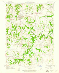
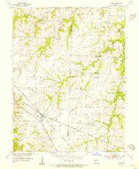
1959 Map of Madison
USGS Topo · Published 1960About this map
The Wabash railroad cuts across the northern Missouri landscape, connecting the agricultural communities of Madison and Holliday. This 1959 survey reveals a rural society structured around watercourses and family legacies, with the Elk Fork Salt River and its many tributaries, such as Pedee Branch and Buck Branch, carving deep, wooded draws through the open fields of Marion and Union townships. Local history and genealogy are well-preserved through numerous rural burial grounds, including Sunset Hill Cemetery, Dunaway Cem, Swindell Cem, and Old Prairie Cem. While the terrain is primarily agricultural, small-scale industrial sites like a Mine and a Quarry indicate the extraction of local resources. This map serves as a precise record of Monroe County's mid-century rural infrastructure before the widespread consolidation of small farmsteads and rural roads.
Find a feature on this map
19 named features on this map. Tap any name to fly to it.
Don’t see what you’re looking for? This feature index may not catch every label — zoom into the map to look around manually.
Map Details
Editions of this 1959 Madison Map
This is the sole edition of this map. No revisions or reprints were ever made.
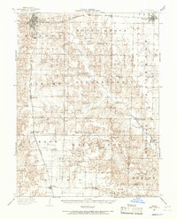
Other maps of this area

1890 · Moberly
USGS Topo · 1:125,000
1908 · Macon
USGS Topo · 1:62,500
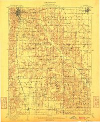
1910 · Macon
USGS Topo · 1:62,500
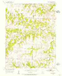
1952 · Middle Grove
USGS Topo · 1:24,000

1953 · Moberly
USGS Topo · 1:250,000
1953 · Clark
USGS Topo · 1:24,000

1954 · Moberly
USGS Topo · 1:250,000

1957 · Moberly
USGS Topo · 1:250,000
1958 · Tulip
USGS Topo · 1:24,000
1959 · Woodlawn
USGS Topo · 1:24,000