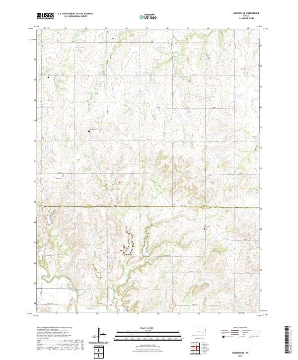
2022 Map of Madison NE
USGS Topo · Published 2022About this map
Fairview Cemetery and Maydale Cemetery sit within the rural uplands north of the Lyon County and Greenwood County line, marking the early settlement of this prairie landscape. The area is defined by a dendritic network of streams that feed the southern drainage, including Harper Creek, Hoosier Creek, and the small tributaries of Tate Branch Creek. These waterways dictate the rugged contours of the terrain before they consolidate toward the Verdigris River in the southwestern corner. Farther east, the Lena Valley Cemetery rests near the headwaters of Halderman Creek, illustrating how early community life followed the high ground between these varied creek valleys. The section-line road grid, including County Road 102 and 390th Street, reflects the enduring structure of the Public Land Survey System in this part of eastern Kansas.
Find a feature on this map
35 named features on this map. Tap any name to fly to it.
Don’t see what you’re looking for? This feature index may not catch every label — zoom into the map to look around manually.
Map Details
Editions of this 2022 Madison NE Map
This is the sole edition of this map. No revisions or reprints were ever made.
Other maps of this area

1885 · Burlington
USGS Topo · 1:125,000

1888 · Emporia
USGS Topo · 1:125,000

1894 · Emporia
USGS Topo · 1:125,000

1894 · Burlington
USGS Topo · 1:125,000

1947 · Lawrence
USGS Topo · 1:250,000

1950 · Lawrence
USGS Topo · 1:250,000

1955 · Hutchinson
USGS Topo · 1:250,000

1956 · Lawrence
USGS Topo · 1:250,000

1959 · Hutchinson
USGS Topo · 1:250,000

1961 · Lawrence
USGS Topo · 1:250,000