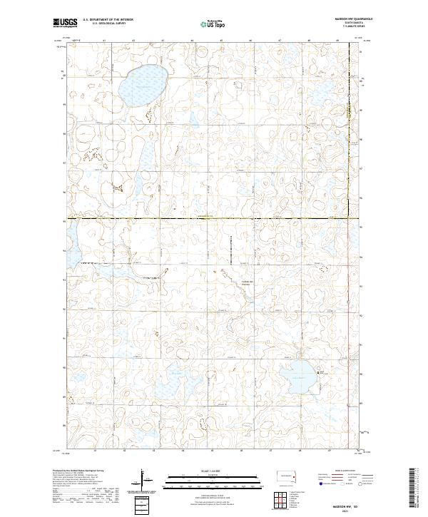
2021 Map of Madison NW
USGS Topo · Published 2021About this map
Lake Badus and the surrounding glacial prairie of the Coteau des Prairies plateau define the landscape of northwestern Lake County in this 2021 survey. The region is characterized by a high concentration of wetlands and water bodies, including Spring Lake in the north and the expansive Dry Lake to the south. Historically, the area near Lake Badus was a center for Swiss-German settlement, a heritage reflected by the location of Saint Ann's Cem along its eastern shore. Agricultural life is structured by a rigorous grid of section roads such as 453rd Ave and Co Hwy 10, while Battle Cr provides the primary natural drainage through this upland terrain. The map also delineates the shared borders with Kingsbury and Brookings counties, illustrating the rural connectivity and land management patterns of contemporary South Dakota.
Find a feature on this map
36 named features on this map. Tap any name to fly to it.
Don’t see what you’re looking for? This feature index may not catch every label — zoom into the map to look around manually.
Map Details
Editions of this 2021 Madison NW Map
This is the sole edition of this map. No revisions or reprints were ever made.
Other maps of this area

1953 · Watertown
USGS Topo · 1:250,000

1958 · Watertown
USGS Topo · 1:250,000

1968 · Lake Sinai
USGS Topo · 1:24,000

1968 · Lake Preston East
USGS Topo · 1:24,000

1968 · Arlington
USGS Topo · 1:24,000

1968 · Ramona
USGS Topo · 1:24,000

1968 · Madison
USGS Topo · 1:24,000

1968 · Sinai
USGS Topo · 1:24,000

1968 · Oldham
USGS Topo · 1:24,000

1968 · Oldham SE
USGS Topo · 1:24,000
Featured Places
- Wayne Township, SD
- Lake Sinai Township, SD
- Spring Lake Hutterite Colony, SD
- Nunda Township, SD
- Badus Township, SD