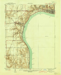
1939 Map of Madison West
USGS Topo · Published 1939About this map
Clifty Falls State Park and the steep bluffs overlooking the Ohio River dominate this 1938 survey of Jefferson County. The terrain is defined by a series of dramatic cascades where small tributaries drop toward the river valley, including Chain Mill Falls, Fremont Falls, and Harts Falls. These geographical features influenced the settlement patterns of Hanover and the surrounding townships, where Hanover College sits perched above Hanover Beach.
Find a feature on this map
47 named features on this map. Tap any name to fly to it.
Don’t see what you’re looking for? This feature index may not catch every label — zoom into the map to look around manually.
Map Details
Editions of this 1939 Madison West Map
3 editions found
Other maps of this area

1939 · Bethlehem
USGS Topo · 1:24,000

1939 · Madison West
USGS Topo · 1:24,000

1948 · Bethlehem
USGS Topo · 1:24,000

1948 · Madison West
USGS Topo · 1:24,000

1953 · Madison West
USGS Topo · 1:24,000

1953 · Bedford
USGS Topo · 1:24,000

1953 · Madison East
USGS Topo · 1:24,000

1953 · Bethlehem
USGS Topo · 1:24,000

1956 · Volga
USGS Topo · 1:24,000

1956 · Kent
USGS Topo · 1:24,000