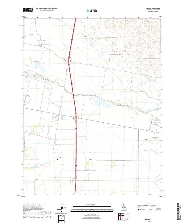
2021 Map of Madison
USGS Topo · Published 2021About this map
The Madison area in the Sacramento Valley is defined by an intricate network of irrigation and natural drainage systems that support its agricultural character. This survey reveals a landscape where natural watercourses like Cache Creek and Cottonwood Slough meet engineered waterways including the W Canal, Alder Canal, and Winters Canal. The terrain transitions from the level floor of the Central Valley into the rising elevations of the Dunnigan Hills to the north and the Monument Hills to the east. Historically centered on the settlement of Madison and the nearby Citrona rail siding, the region maintains its rural roots through sites like the Cottonwood Cem. The map illustrates how local topography, such as the Hungry Hollow depression, has historically dictated the placement of roads and the routing of sloughs across the Yolo County plains.
Find a feature on this map
53 named features on this map. Tap any name to fly to it.
Don’t see what you’re looking for? This feature index may not catch every label — zoom into the map to look around manually.
Map Details
Editions of this 2021 Madison Map
This is the sole edition of this map. No revisions or reprints were ever made.
Other maps of this area

1905 · Esparto
USGS Topo · 1:24,000

1907 · Dunnigan
USGS Topo · 1:62,500

1907 · Woodland
USGS Topo · 1:62,500

1915 · Yolo
USGS Topo · 1:31,680

1915 · Ronda
USGS Topo · 1:31,680

1915 · Merritt
USGS Topo · 1:31,680

1916 · Jacobs Corner
USGS Topo · 1:31,680

1916 · Zamora
USGS Topo · 1:31,680

1916 · Winters
USGS Topo · 1:31,680

1916 · Esparto
USGS Topo · 1:31,680