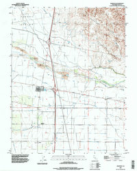
1992 Map of Madison
USGS Topo · Published 1997About this map
The agricultural heart of Yolo County is meticulously documented in this 1990s-era study, defined by a complex network of irrigation and drainage. Madison sits at a critical junction where infrastructure meets the natural flow of Cache Creek, surrounded by an intricate system of waterways including the Winters Canal, Alder Canal, and Moore Canal. This water management system underscores the area's transition from the elevated Dunnigan Hills and Hungry Hollow to the fertile lowlands of the Sacramento Valley.
Find a feature on this map
20 named features on this map. Tap any name to fly to it.
Don’t see what you’re looking for? This feature index may not catch every label — zoom into the map to look around manually.
Map Details
Editions of this 1992 Madison Map
This is the sole edition of this map. No revisions or reprints were ever made.
Other maps of this area

1905 · Esparto
USGS Topo · 1:24,000

1907 · Dunnigan
USGS Topo · 1:62,500

1907 · Woodland
USGS Topo · 1:62,500

1915 · Yolo
USGS Topo · 1:31,680

1915 · Ronda
USGS Topo · 1:31,680

1915 · Merritt
USGS Topo · 1:31,680

1916 · Jacobs Corner
USGS Topo · 1:31,680

1916 · Zamora
USGS Topo · 1:31,680

1916 · Winters
USGS Topo · 1:31,680

1916 · Esparto
USGS Topo · 1:31,680