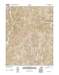
2013 Map of Madisonville
USGS Topo · Published 2013About this map
Madisonville and the crossroads of Vincent Corner anchor this rural landscape in Charlotte County during the early 21st century. The terrain is defined by a dense network of creek branches, including Rattlesnake Br and Butterwood Cr, which feed into larger water management structures like the Roanoke Creek Site 4a Lake. High points such as Lyle Mountain and Baker Mountain rise above the agricultural and timbered lands. Local history is evident in the naming of rural tracks and industrial remnants, such as the Maloney Siding rail feature and the Wards Fork Mill located near the southern border. The map illustrates a region where life follows the natural contours of the land, with small settlements like Taro connected by state routes and named family roads including Vincent Store Rd and Thorntons Mill Rd.
Find a feature on this map
89 named features on this map. Tap any name to fly to it.
Don’t see what you’re looking for? This feature index may not catch every label — zoom into the map to look around manually.
Map Details
Editions of this 2013 Madisonville Map
This is the sole edition of this map. No revisions or reprints were ever made.
Other maps of this area

1892 · Appomattox
USGS Topo · 1:125,000

1947 · Roanoke
USGS Topo · 1:250,000

1956 · Brookneal
USGS Topo · 1:62,500

1956 · Charlotte Court House
USGS Topo · 1:62,500

1958 · Appomattox
USGS Topo · 1:62,500

1958 · Pamplin City
USGS Topo · 1:62,500

1959 · Roanoke
USGS Topo · 1:250,000

1963 · Roanoke
USGS Topo · 1:250,000
1967 · Prospect
USGS Topo · 1:24,000
1968 · Red House
USGS Topo · 1:24,000