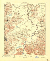
1909 Map of Madisonville
USGS Topo · Published 1941About this map
Pond River serves as a winding natural boundary between several Western Kentucky counties, anchoring a landscape defined by its river-and-rail economy in the early twentieth century. The Louisville and Nashville and St Louis and Nashville railroads provide the primary transportation corridors, connecting established centers like Madisonville and Earlington with smaller agricultural and mining hubs. The map reveals a highly decentralized rural infrastructure, where social life centered on numerous country schools and churches such as Old Salem Church, Bethlehem Church, and the New Providence School. Crossing the river required the use of localized infrastructure like Bells Ferry or the Island Ford. Landmarks like Philips Store and geographic features like The Island provide specific reference points for genealogists tracking family land and early commerce in this coal-rich region.
Find a feature on this map
60 named features on this map. Tap any name to fly to it.
Don’t see what you’re looking for? This feature index may not catch every label — zoom into the map to look around manually.
Map Details
Editions of this 1909 Madisonville Map
3 editions found
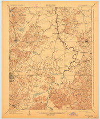
Other maps of this area

1906 · Sebree
USGS Topo · 1:62,500

1906 · Sutherland
USGS Topo · 1:62,500

1907 · Earlington
USGS Topo · 1:48,000

1908 · Calhoun
USGS Topo · 1:62,500

1909 · Dawson Springs
USGS Topo · 1:48,000

1909 · Earlington
USGS Topo · 1:62,500

1909 · Madisonville
USGS Topo · 1:62,500

1909 · Central City
USGS Topo · 1:62,500

1911 · Dawson Springs
USGS Topo · 1:62,500

1911 · Drakesboro
USGS Topo · 1:48,000