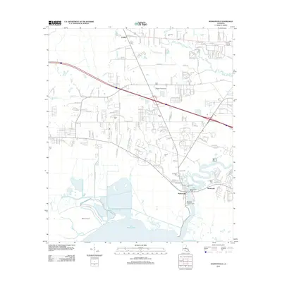
2012 Map of Madisonville
USGS Topo · Published 2012About this map
Madisonville sits at the confluence of the Tchefuncte River and Lake Pontchartrain, serving as a critical point of navigation in this corner of Louisiana. The landscape is defined by the winding paths of the Black River and Bayou De Zaire, which carve through the low-lying terrain north of Miltons Island. This area preserves numerous family-named landmarks and historical burial sites, including Daussin Cem, White Cem, and Helping Hands Cem, reflecting a deep genealogy tied to the land.
Find a feature on this map
180 named features on this map. Tap any name to fly to it.
Don’t see what you’re looking for? This feature index may not catch every label — zoom into the map to look around manually.
Map Details
Editions of this 2012 Madisonville Map
This is the sole edition of this map. No revisions or reprints were ever made.
Other maps of this area

1935 · Covington
USGS Topo · 1:62,500

1935 · Ponchatoula
USGS Topo · 1:62,500

1939 · Ponchatoula
USGS Topo · 1:62,500

1939 · Covington
USGS Topo · 1:62,500

1942 · Onville
USGS Topo · 1:31,680

1942 · Waldheim
USGS Topo · 1:31,680

1942 · Robert
USGS Topo · 1:31,680

1950 · Covington
USGS Topo · 1:62,500

1951 · Ponchatoula
USGS Topo · 1:62,500

1954 · Folsom
USGS Topo · 1:62,500