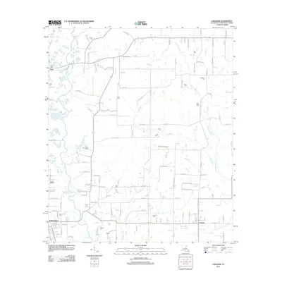
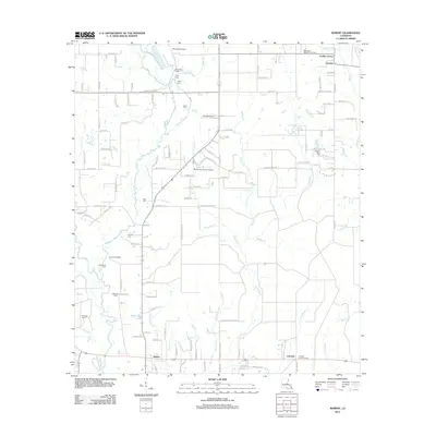
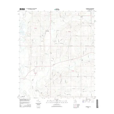
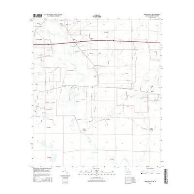
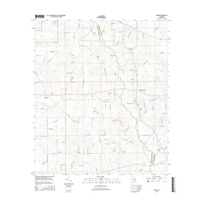
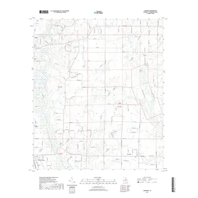
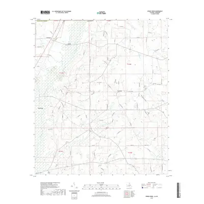
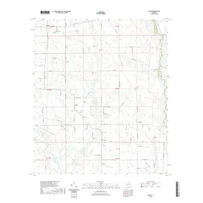
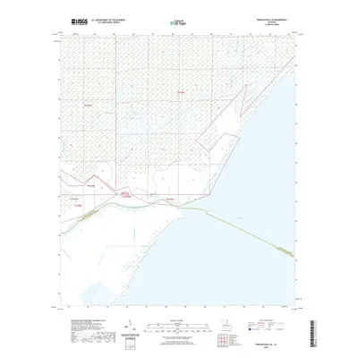
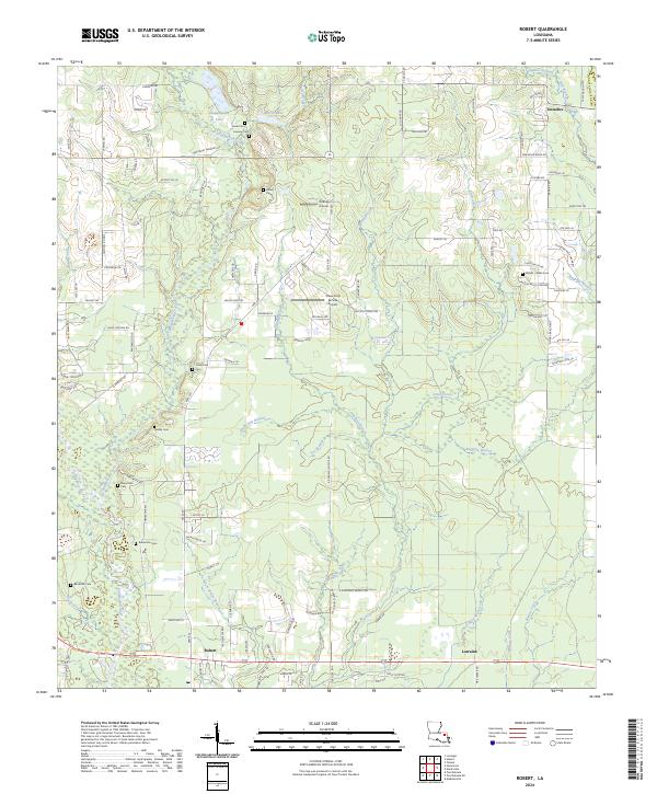
1942 Map of Robert
USGS Topo · Published 1942About this map
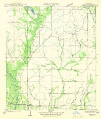
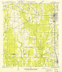
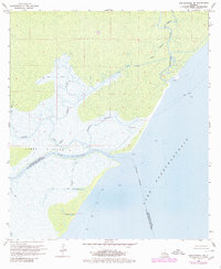
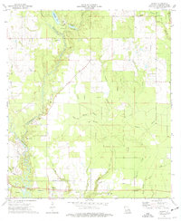
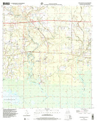
The Tangipahoa River and Chefuncte River define the hydraulic landscape of this Tangipahoa Parish region in the early 1940s. Centered around the settlement of Robert, the map reveals a rural network of farm-to-market roads and the Illinois Central railroad corridor. Local genealogy is well-preserved through numerous family-named landmarks including Henen Cem, Joiner Cem, and Reid Cem, alongside community anchors like Uneedus Sch and Mt Zion Ch. The presence of the Hammond Fire Tower and Zemurray Lodge suggests the importance of timber and land management during this era. A complex system of tributaries, including Chappepeela Creek and Washley Creek, feeds into the larger river systems, illustrating the wetland character of the Louisiana interior before modern drainage and highway development significantly altered the drainage patterns.
Find a feature on this map
39 named features on this map. Tap any name to fly to it.
Don’t see what you’re looking for? This feature index may not catch every label — zoom into the map to look around manually.
Map Details
Editions of this 1942 Robert Map
This is the sole edition of this map. No revisions or reprints were ever made.
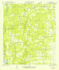
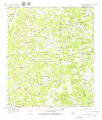
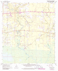
Historical Maps of Lorraine Through Time
70 maps found
1940 Spring Creek
Tangipahoa Parish, LA

1942 Husser
Tangipahoa Parish, LA
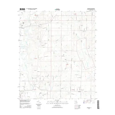
1942 Loranger
Tangipahoa Parish, LA
1942 Robert
Tangipahoa Parish, LA
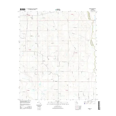
1942 Wilmer
Tangipahoa Parish, LA
1949 Amite
Tangipahoa Parish, LA
1949 Bolivar
Tangipahoa Parish, LA
1958 Mount Hermon
Tangipahoa Parish, LA

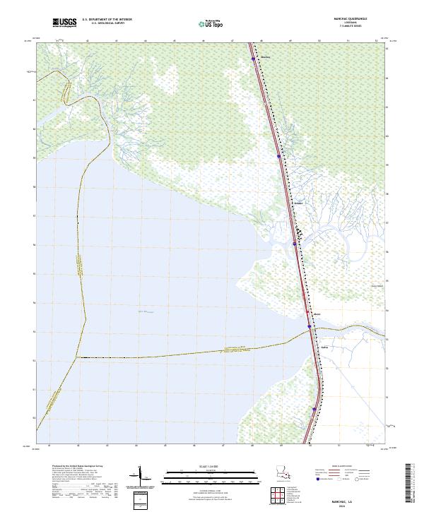
1968 Manchac
Tangipahoa Parish, LA
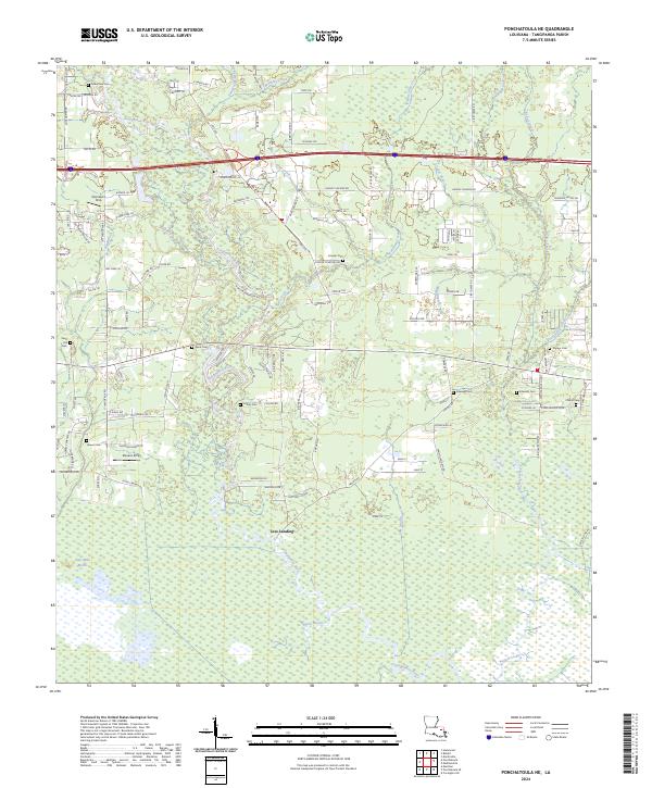
1968 Ponchatoula NE
Tangipahoa Parish, LA
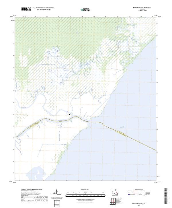
1968 Ponchatoula SE
Tangipahoa Parish, LA
1974 Amite
Tangipahoa Parish, LA
1974 Husser
Tangipahoa Parish, LA
1974 Loranger
Tangipahoa Parish, LA
1974 Robert
Tangipahoa Parish, LA

1983 Amite
Tangipahoa Parish, LA
1983 Chesbrough
Tangipahoa Parish, LA
1983 Spring Creek
Tangipahoa Parish, LA
1983 Wilmer
Tangipahoa Parish, LA
1998 Ponchatoula NE
Tangipahoa Parish, LA
2012 Amite
Tangipahoa Parish, LA
2012 Chesbrough
Tangipahoa Parish, LA
2012 Husser
Tangipahoa Parish, LA
2012 Loranger
Tangipahoa Parish, LA
2012 Manchac
Tangipahoa Parish, LA
2012 Ponchatoula NE
Tangipahoa Parish, LA
2012 Ponchatoula SE
Tangipahoa Parish, LA
2012 Robert
Tangipahoa Parish, LA
2012 Spring Creek
Tangipahoa Parish, LA
2012 Wilmer
Tangipahoa Parish, LA
2015 Amite
Tangipahoa Parish, LA
2015 Chesbrough
Tangipahoa Parish, LA
2015 Husser
Tangipahoa Parish, LA
2015 Loranger
Tangipahoa Parish, LA
2015 Manchac
Tangipahoa Parish, LA
2015 Ponchatoula NE
Tangipahoa Parish, LA
2015 Ponchatoula SE
Tangipahoa Parish, LA
2015 Robert
Tangipahoa Parish, LA
2015 Spring Creek
Tangipahoa Parish, LA
2015 Wilmer
Tangipahoa Parish, LA
2018 Amite
Tangipahoa Parish, LA
2018 Chesbrough
Tangipahoa Parish, LA
2018 Husser
Tangipahoa Parish, LA
2018 Loranger
Tangipahoa Parish, LA
2018 Manchac
Tangipahoa Parish, LA
2018 Ponchatoula NE
Tangipahoa Parish, LA

2018 Ponchatoula SE
Tangipahoa Parish, LA
2018 Robert
Tangipahoa Parish, LA
2018 Spring Creek
Tangipahoa Parish, LA
2018 Wilmer
Tangipahoa Parish, LA
2020 Amite
Tangipahoa Parish, LA
2020 Chesbrough
Tangipahoa Parish, LA
2020 Husser
Tangipahoa Parish, LA
2020 Loranger
Tangipahoa Parish, LA
2020 Manchac
Tangipahoa Parish, LA
2020 Ponchatoula NE
Tangipahoa Parish, LA
2020 Ponchatoula SE
Tangipahoa Parish, LA
2020 Robert
Tangipahoa Parish, LA
2020 Spring Creek
Tangipahoa Parish, LA
2020 Wilmer
Tangipahoa Parish, LA
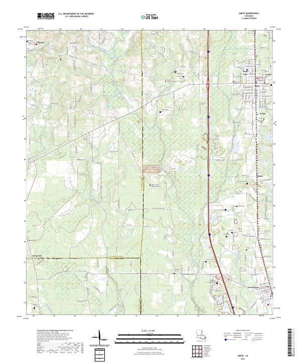
2024 Amite
Tangipahoa Parish, LA
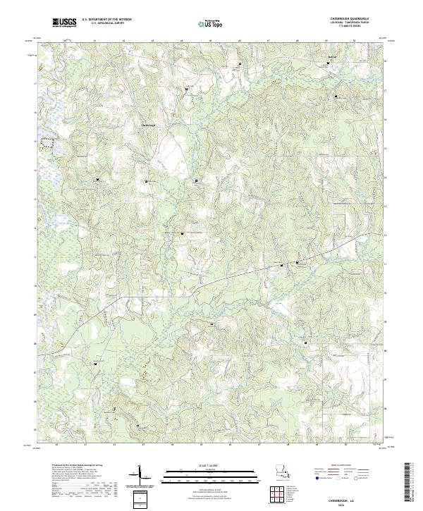
2024 Chesbrough
Tangipahoa Parish, LA
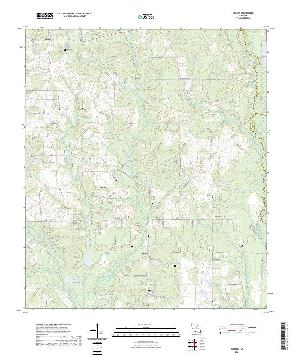
2024 Husser
Tangipahoa Parish, LA
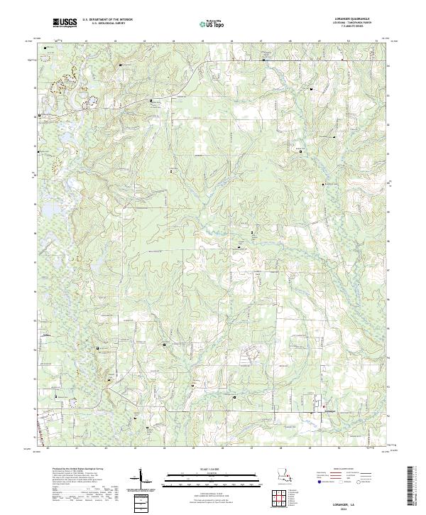
2024 Loranger
Tangipahoa Parish, LA
2024 Manchac
Tangipahoa Parish, LA
2024 Ponchatoula NE
Tangipahoa Parish, LA
2024 Ponchatoula SE
Tangipahoa Parish, LA
2024 Robert
Tangipahoa Parish, LA
2024 Spring Creek
Tangipahoa Parish, LA
2024 Wilmer
Tangipahoa Parish, LA