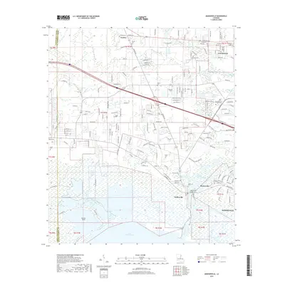
2018 Map of Madisonville
USGS Topo · Published 2018About this map
The Tchefuncte River winds through the heart of this coastal St. Tammany Parish landscape, marking the transition from the piney woods of Goodbee and Covington toward the expansive waters of Lake Pontchartrain. Along its banks, the established maritime and residential patterns of Madisonville and Houltonville are clearly defined, including the strategic Madisonville Bridge. This area is characterized by its complex network of waterways, including Bayou De Zaire and Soap and Tallow Branch, which have historically shaped the local economy and development patterns.
Find a feature on this map
183 named features on this map. Tap any name to fly to it.
Don’t see what you’re looking for? This feature index may not catch every label — zoom into the map to look around manually.
Map Details
Editions of this 2018 Madisonville Map
This is the sole edition of this map. No revisions or reprints were ever made.
Other maps of this area

1935 · Covington
USGS Topo · 1:62,500

1935 · Ponchatoula
USGS Topo · 1:62,500

1939 · Ponchatoula
USGS Topo · 1:62,500

1939 · Covington
USGS Topo · 1:62,500

1942 · Onville
USGS Topo · 1:31,680

1942 · Waldheim
USGS Topo · 1:31,680

1942 · Robert
USGS Topo · 1:31,680

1950 · Covington
USGS Topo · 1:62,500

1951 · Ponchatoula
USGS Topo · 1:62,500

1954 · Folsom
USGS Topo · 1:62,500