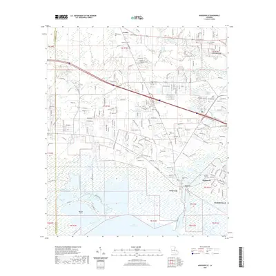
2020 Map of Madisonville
USGS Topo · Published 2020About this map
The Tchefuncte River meanders toward its mouth at Lake Pontchartrain, anchoring a landscape defined by the historic riverfront communities of Madisonville and Houltonville. This coastal reach of St. Tammany Parish showcases the transition from the piney woods of Goodbee to the marshy lowlands near Miltons Island and Blue Swamp. The settlement pattern is characterized by numerous family and community burial grounds, including Galatas Cem, Saint James Cem, and the Helping Hand Cem, which offer significant value for genealogical research in this corridor. Modern infrastructure like I-12 and the Madisonville Bridge intersect with older drainage features like Bayou De Zaire and Soap and Tallow Br, illustrating how the region's transport network has evolved to span the various bayous and creeks feeding into the larger basin.
Find a feature on this map
41 named features on this map. Tap any name to fly to it.
Don’t see what you’re looking for? This feature index may not catch every label — zoom into the map to look around manually.
Map Details
Editions of this 2020 Madisonville Map
This is the sole edition of this map. No revisions or reprints were ever made.
Other maps of this area

1935 · Covington
USGS Topo · 1:62,500

1935 · Ponchatoula
USGS Topo · 1:62,500

1939 · Ponchatoula
USGS Topo · 1:62,500

1939 · Covington
USGS Topo · 1:62,500

1942 · Onville
USGS Topo · 1:31,680

1942 · Waldheim
USGS Topo · 1:31,680

1942 · Robert
USGS Topo · 1:31,680

1950 · Covington
USGS Topo · 1:62,500

1951 · Ponchatoula
USGS Topo · 1:62,500

1954 · Folsom
USGS Topo · 1:62,500