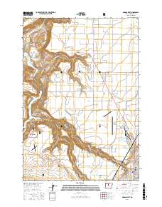
2017 Map of Madras West
USGS Topo · Published 2017About this map
Agency Plains and Little Agency Plains define the elevated agricultural landscape north of the city of Madras, where the high desert meets deep basalt canyons. This 2017 survey details the complex intersection of the regional water economy and industrial geography, from the Pelton Regulating Reservoir and Lake Simtustus on the Deschutes River to the Jefferson Plywood Company Mill Pond in the urban center. Family history is anchored by the Milo Gard Cem and Round Butte Cem, while the southern reaches extend into the Crooked River National Grassland. The map traces a network of canyon access points like Hurlbert Canyon and the Willow Creek Canyon Trl, providing a precise record of contemporary infrastructure alongside prominent landmarks such as the Madras Municipal Airport and Bombay Farms Airport.
Find a feature on this map
55 named features on this map. Tap any name to fly to it.
Don’t see what you’re looking for? This feature index may not catch every label — zoom into the map to look around manually.
Map Details
Editions of this 2017 Madras West Map
This is the sole edition of this map. No revisions or reprints were ever made.
Other maps of this area

1928 · Madras
USGS Topo · 1:125,000

1931 · Madras
USGS Topo · 1:125,000

1955 · Bend
USGS Topo · 1:250,000

1957 · Bend
USGS Topo · 1:250,000

1958 · Bend
USGS Topo · 1:250,000

1962 · Eagle Butte
USGS Topo · 1:24,000
1962 · Seekseequa Junction
USGS Topo · 1:24,000

1962 · Gateway
USGS Topo · 1:24,000
1962 · Round Butte Dam
USGS Topo · 1:24,000
1963 · Culver
USGS Topo · 1:24,000