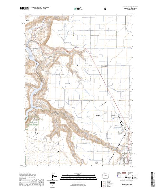
2024 Map of Madras West
USGS Topo · Published 2024About this map
Madras sits at the eastern edge of a dramatic landscape where the plateau of Agency Plains meets the deep incisions of the Deschutes River canyon. This modern survey illustrates the proximity of civic life and industrial infrastructure, from the Jefferson County Courthouse in the south to the Jefferson Plywood Company Mill Pond near the city center. The geography is defined by sharp elevation changes, particularly where Willow Creek and Campbell Creek carve through the basalt towards Lake Simtustus and the Pelton Regulating Reservoir. To the southwest, the Crooked River National Grassland encompasses several landforms like Jackson Buttes and Hurbers Canyon. Local family history is rooted in the landscape at the Milo Gard Cem and Round Butte Cem, while the Deschutes Wild and Scenic River corridor remains a protected natural feature along the western boundary.
Find a feature on this map
83 named features on this map. Tap any name to fly to it.
Don’t see what you’re looking for? This feature index may not catch every label — zoom into the map to look around manually.
Map Details
Editions of this 2024 Madras West Map
This is the sole edition of this map. No revisions or reprints were ever made.
Other maps of this area

1928 · Madras
USGS Topo · 1:125,000

1931 · Madras
USGS Topo · 1:125,000

1955 · Bend
USGS Topo · 1:250,000

1957 · Bend
USGS Topo · 1:250,000

1958 · Bend
USGS Topo · 1:250,000

1962 · Eagle Butte
USGS Topo · 1:24,000
1962 · Seekseequa Junction
USGS Topo · 1:24,000

1962 · Gateway
USGS Topo · 1:24,000
1962 · Round Butte Dam
USGS Topo · 1:24,000
1963 · Culver
USGS Topo · 1:24,000