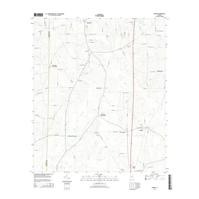
2014 Map of Madrid
USGS Topo · Published 2014About this map
The town of Madrid anchors this 2014 survey of southeast Alabama, situated just north of the State Line where the local road network converges. The landscape is defined by the gentle drainage of Big Creek and Limestone Creek, with several family-named water bodies such as Registers Pond and Singletarys Pond scattered across the terrain. Numerous small settlements and historic intersections illustrate the rural heritage of Houston County, including Garrettts Crossroads, Merritts Crossroads, and the community of Rehobeth at the northern edge. For genealogists, the map is particularly useful for locating several rural burial sites, such as Saint Phillips Cem, Sanders Cem, and Lassiter Cem. The southern reach of the sheet captures Southern Junction, showing the intersection of Al-109 and Us-231, a primary transit artery for the region.
Find a feature on this map
111 named features on this map. Tap any name to fly to it.
Don’t see what you’re looking for? This feature index may not catch every label — zoom into the map to look around manually.
Map Details
Editions of this 2014 Madrid Map
This is the sole edition of this map. No revisions or reprints were ever made.
Other maps of this area

1942 · Enterprise
USGS Topo · 1:125,000

1951 · Graceville
USGS Topo · 1:24,000

1952 · Campbellton
USGS Topo · 1:24,000

1952 · Sills
USGS Topo · 1:24,000

1953 · Dothan
USGS Topo · 1:250,000

1954 · Dothan
USGS Topo · 1:250,000

1954 · Tallahassee
USGS Topo · 1:250,000

1955 · Dothan
USGS Topo · 1:250,000

1957 · Malvern
USGS Topo · 1:24,000

1957 · Hartford
USGS Topo · 1:62,500