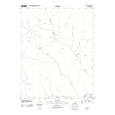
2010 Map of Madrid
USGS Topo · Published 2010About this map
Mining operations and rural education define the landscape of this Colorado territory, where numerous extraction sites like the Deer Canyon Mine and Stanley Mine are tucked into the drainages of Reilly Canyon and Burro Canyon. The settlement of Boncarbo serves as a central point in a region heavily shaped by the coal and mineral industries of Las Animas County. The distribution of Midway School and the Colorado Standard School suggests a dispersed community of workers and families living near the worksites.
Find a feature on this map
42 named features on this map. Tap any name to fly to it.
Don’t see what you’re looking for? This feature index may not catch every label — zoom into the map to look around manually.
Map Details
Editions of this 2010 Madrid Map
This is the sole edition of this map. No revisions or reprints were ever made.
Other maps of this area

1891 · Spanish Peaks
USGS Topo · 1:125,000

1893 · Spanish Peaks
USGS Topo · 1:125,000

1895 · Spanish Peaks
USGS Topo · 1:125,000

1897 · Spanish Peaks
USGS Topo · 1:125,000

1900 · Spanish Peaks
USGS Topo · 1:125,000

1951 · Trinidad
USGS Topo · 1:24,000

1951 · Valdez
USGS Topo · 1:24,000

1951 · Madrid
USGS Topo · 1:24,000
1951 · Starkville
USGS Topo · 1:24,000

1954 · Trinidad
USGS Topo · 1:250,000