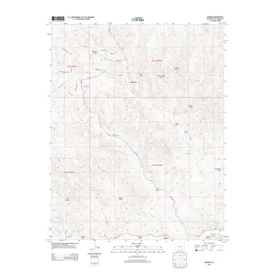
2013 Map of Madrid
USGS Topo · Published 2013About this map
Picketwire Valley forms a significant geographical corridor in the southern reaches of this landscape, where the Purgatoire River flows past the small communities of Madrid and Tijeras. This area of Las Animas County is defined by a dense network of drainages and named canyons, including Reilly Canyon, Burro Canyon, and Chinamans Canyon. For local historians and genealogists, the map identifies specific community landmarks such as the Burro Canyon Cem and San Juan Cem, alongside the sites of the Midway School and Colorado Standard School. The settlement at Boncarbo sits central to the northern hills, connected by a series of county roads like Co RD-32.8 that traverse the high ridges and deep draws characteristic of the region.
Find a feature on this map
50 named features on this map. Tap any name to fly to it.
Don’t see what you’re looking for? This feature index may not catch every label — zoom into the map to look around manually.
Map Details
Editions of this 2013 Madrid Map
This is the sole edition of this map. No revisions or reprints were ever made.
Other maps of this area

1891 · Spanish Peaks
USGS Topo · 1:125,000

1893 · Spanish Peaks
USGS Topo · 1:125,000

1895 · Spanish Peaks
USGS Topo · 1:125,000

1897 · Spanish Peaks
USGS Topo · 1:125,000

1900 · Spanish Peaks
USGS Topo · 1:125,000

1951 · Trinidad
USGS Topo · 1:24,000

1951 · Valdez
USGS Topo · 1:24,000

1951 · Madrid
USGS Topo · 1:24,000
1951 · Starkville
USGS Topo · 1:24,000

1954 · Trinidad
USGS Topo · 1:250,000