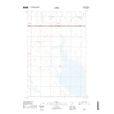
2020 Map of Mae
USGS Topo · Published 2020About this map
The agricultural landscape of Mae and the surrounding Mae Valley is defined by a sophisticated network of irrigation and drainage infrastructure in the Columbia Basin. Canal W 20 and the Winchester Wasteway anchor the regional water management system, supporting the small settlements that emerged as this arid region was transformed into productive farmland. The map reveals a strict rectilinear grid of rural roads, including Hiawatha Rd NE and Division Rd N, which delineate family holdings and township boundaries. Tucked between these surveyed lines are Hiawatha Valley and Moe Valley, pockets of development that reflect the mid-century expansion of rural Washington. The south is dominated by an intricate pattern of wetlands and coulees, illustrating the complex hydrology where desert terrain meets modern engineering.
Find a feature on this map
25 named features on this map. Tap any name to fly to it.
Don’t see what you’re looking for? This feature index may not catch every label — zoom into the map to look around manually.
Map Details
Editions of this 2020 Mae Map
This is the sole edition of this map. No revisions or reprints were ever made.
Other maps of this area

1910 · Winchester
USGS Topo · 1:62,500

1911 · Red Rock
USGS Topo · 1:62,500

1912 · Moses Lake
USGS Topo · 1:62,500

1923 · Corfu
USGS Topo · 1:62,500

1950 · Smyrna
USGS Topo · 1:62,500

1951 · Smyrna
USGS Topo · 1:62,500

1951 · Corfu
USGS Topo · 1:62,500

1953 · Walla Walla
USGS Topo · 1:250,000

1953 · Ritzville
USGS Topo · 1:250,000

1956 · Moses Lake South
USGS Topo · 1:24,000