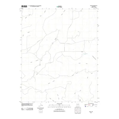
2010 Map of Maes
USGS Topo · Published 2010About this map
Maes sits within a landscape defined by an intricate network of drainage systems in San Miguel County. The terrain is dominated by various canyons, including the extensive Cañon Encinoso and the winding Cañon Pajarita, which shape the local topography. This 2010 survey highlights a sparsely populated area where life is oriented around these natural landmarks and the limited road network.
Find a feature on this map
19 named features on this map. Tap any name to fly to it.
Don’t see what you’re looking for? This feature index may not catch every label — zoom into the map to look around manually.
Map Details
Editions of this 2010 Maes Map
This is the sole edition of this map. No revisions or reprints were ever made.
Other maps of this area

1892 · Watrous
USGS Topo · 1:125,000

1894 · Watrous
USGS Topo · 1:125,000

1954 · Santa Fe
USGS Topo · 1:250,000

1958 · Santa Fe
USGS Topo · 1:250,000

1964 · Frutosa Lake
USGS Topo · 1:24,000

1964 · Canon Ancho
USGS Topo · 1:24,000

1971 · Trujillo
USGS Topo · 1:24,000

1971 · Alamito
USGS Topo · 1:24,000

1971 · Canon Olguin
USGS Topo · 1:24,000
1972 · Maes
USGS Topo · 1:24,000