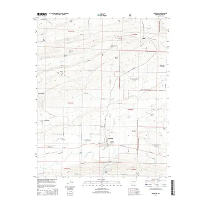
2014 Map of Magazine
USGS Topo · Published 2014About this map
The Magazine settlement and its surrounding Arkansas landscape are defined by the sharp east-west ridges of the Ouachita Mountains, including Backbone Mtn and Hickory Ridge. This 2014 survey captures a mix of timbered slopes within the Ozark National Forest and the agricultural valleys of the Petit Jean River. Evidence of local industry is visible at the Magazine Gas Field north of town, while the historical fabric of the community is preserved through numerous rural burial grounds such as Old Union Cumberland Cem and Ellington Cem. The terrain funnels through a geographic constriction known as The Narrows to the south. Further east, the community of Pleasant Hill sits near the winding waters of Reveille Cr, illustrating the traditional settlement patterns along the region’s creek bottoms and ridge lines.
Find a feature on this map
101 named features on this map. Tap any name to fly to it.
Don’t see what you’re looking for? This feature index may not catch every label — zoom into the map to look around manually.
Map Details
Editions of this 2014 Magazine Map
This is the sole edition of this map. No revisions or reprints were ever made.
Other maps of this area

1879 · Mountain Home
USGS Topo · 1:62,500

1887 · Magazine Mountain #1
USGS Topo · 1:62,500

1887 · Magazine Mountain #4
USGS Topo · 1:62,500

1887 · Magazine Mountain #2
USGS Topo · 1:62,500

1887 · Magazine Mountain #3
USGS Topo · 1:62,500

1887 · Magazine Mountain
USGS Topo · 1:62,500

1890 · Magazine Mountain
USGS Topo · 1:125,000

1934 · Booneville
USGS Topo · 1:48,000

1939 · Booneville
USGS Topo · 1:62,500

1956 · Russellville
USGS Topo · 1:250,000