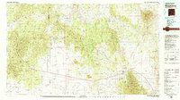
1979 Map of Magdalena
USGS Topo · Published 1979About this map
Magdalena and the nearby settlement of Kelly serve as focal points in this 1979 survey of Socorro County. This high-altitude desert landscape is defined by the convergence of the Magdalena Mountains, Datil Mountains, and Gallinas Mountains, which overlook the expansive San Agustin Plains. The map records a moment when the Atchison Topeka and Santa Fe Railway reached its terminus in the area, a critical link for the local mining and livestock economy.
Find a feature on this map
57 named features on this map. Tap any name to fly to it.
Don’t see what you’re looking for? This feature index may not catch every label — zoom into the map to look around manually.
Map Details
Editions of this 1979 Magdalena Map
This is the sole edition of this map. No revisions or reprints were ever made.
Other maps of this area

1906 · Socorro
USGS Topo · 1:62,500

1916 · La Joya
USGS Topo · 1:125,000

1917 · Cerro Verde
USGS Topo · 1:125,000

1917 · Broom Mountain
USGS Topo · 1:125,000

1918 · Pelona
USGS Topo · 1:125,000

1948 · San Antonio
USGS Topo · 1:62,500

1952 · La Joya NW
USGS Topo · 1:24,000

1952 · San Anacia
USGS Topo · 1:24,000

1952 · Belen SW
USGS Topo · 1:24,000

1954 · Tularosa
USGS Topo · 1:250,000