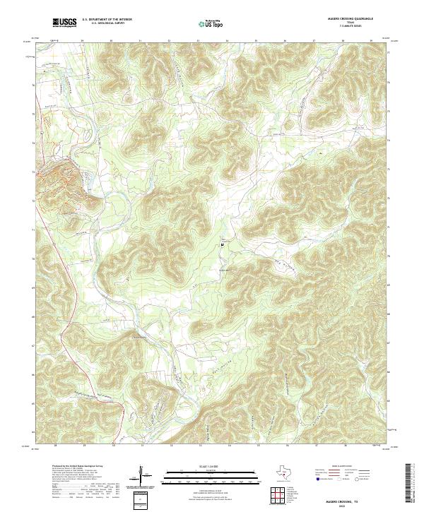
2022 Map of Magers Crossing
USGS Topo · Published 2022About this map
The Frio River carves a deep path through the limestone canyons of the Hill Country on this Uvalde County map. The waterway serves as the primary artery for local life, linking the settlement of Seven Bluff to several remote springs and hollows. The terrain is defined by a dense network of drainages including Bear Cr, Cherry Creek, and Blanket Cr, which cut through high ridges like Coffin Mtn. Evidence of historic land use and conservation work appears in the network of paths such as the Old Ccc Trl, while the Bear Creek Cem stands as a quiet marker of the area's rural heritage. This map illustrates the intersection of modern ranching access via Ranch Rd 1050 and the ancient geomorphology of the Texas river breaks, showing a landscape where water sources like Cold Springs and Cowan Springs remain central to the geography.
Find a feature on this map
60 named features on this map. Tap any name to fly to it.
Don’t see what you’re looking for? This feature index may not catch every label — zoom into the map to look around manually.
Map Details
Editions of this 2022 Magers Crossing Map
This is the sole edition of this map. No revisions or reprints were ever made.
Other maps of this area

1898 · Uvalde
USGS Topo · 1:125,000

1899 · Uvalde
USGS Topo · 1:125,000

1954 · San Antonio
USGS Topo · 1:250,000

1956 · Utopia
USGS Topo · 1:62,500

1957 · San Antonio
USGS Topo · 1:250,000

1957 · York Hollow
USGS Topo · 1:62,500

1960 · Concan
USGS Topo · 1:24,000

1960 · Magers Crossing
USGS Topo · 1:24,000
1969 · Vanderpool
USGS Topo · 1:24,000
1969 · Trio
USGS Topo · 1:24,000