
1960 Map of Concan
USGS Topo · Published 1962About this map
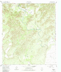
The Frio River carves a winding path through the limestone hills of Uvalde County, creating a landscape defined by dramatic canyons and traditional Texas ranching operations. At the northern edge, the small settlement of Concan sits near the The Shut-in, a natural narrowing of the river valley. The map documents a series of established family holdings, including Stoner Ranch, Meyer Ranch, and Van Pelt Ranch, illustrating the rural land use patterns of the early 1960s.
Find a feature on this map
31 named features on this map. Tap any name to fly to it.
Don’t see what you’re looking for? This feature index may not catch every label — zoom into the map to look around manually.
Map Details
Editions of this 1960 Concan Map
2 editions found
Other maps of this area

1898 · Uvalde
USGS Topo · 1:125,000

1899 · Uvalde
USGS Topo · 1:125,000

1954 · San Antonio
USGS Topo · 1:250,000

1956 · Utopia
USGS Topo · 1:62,500

1957 · San Antonio
USGS Topo · 1:250,000

1957 · York Hollow
USGS Topo · 1:62,500

1960 · Magers Crossing
USGS Topo · 1:24,000
1969 · Trio
USGS Topo · 1:24,000
1969 · Utopia
USGS Topo · 1:24,000
1971 · Sevenmile Hill
USGS Topo · 1:24,000