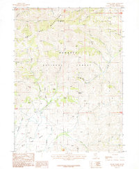
1987 Map of Maggie Summit
USGS Topo · Published 1987About this map
The Bull Run Mountains dominate this high-altitude landscape in the 1980s, revealing a history of mineral extraction within the Humboldt National Forest. Prospecting activity is evident through the presence of the Blue Jacket Mine, Aura King Mine, and Golden Eagle Mine, situated among steep drainages like California Gulch and Maggie Gulch. This period shows the persistence of isolated mountain agriculture at the Columbia Ranch, located near the headwaters of Columbia Creek. The terrain transitions from the rugged peaks of Pennsylvania Hill down into the expansive Bull Run Basin and Columbia Basin to the south. Notable geographic landmarks include Maggie Summit and a network of named watercourses such as Silver Creek and Alexander Creek, which trace the complex hydrology of northern Elko County.
Find a feature on this map
38 named features on this map. Tap any name to fly to it.
Don’t see what you’re looking for? This feature index may not catch every label — zoom into the map to look around manually.
Map Details
Editions of this 1987 Maggie Summit Map
This is the sole edition of this map. No revisions or reprints were ever made.
Other maps of this area

1936 · Mountain City
USGS Topo · 1:62,500

1939 · Owyhee
USGS Topo · 1:62,500

1940 · Mountain City
USGS Topo · 1:62,500

1942 · Owyhee
USGS Topo · 1:62,500

1955 · McDermitt
USGS Topo · 1:250,000

1955 · Wells
USGS Topo · 1:250,000

1956 · Bull Run
USGS Topo · 1:62,500

1956 · Wild Horse
USGS Topo · 1:62,500

1958 · Wells
USGS Topo · 1:250,000

1959 · McDermitt
USGS Topo · 1:250,000