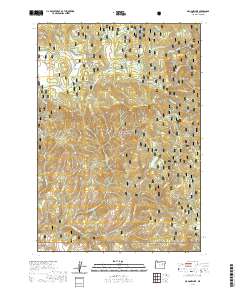
2020 Map of Magone Lake
USGS Topo · Published 2020About this map
Malheur National Forest dominates this section of the Blue Mountains, where the landscape is defined by a dense network of high-elevation meadows and springs. The map centers on the namesake water of Magone Lake, a notable feature in an area otherwise characterized by ridges and peaks like Huckleberry Butte and Lake Butte. A series of natural grazing and water sources, including Keeney Meadows, Flood Meadow, and Morrow Meadow, suggest the land's traditional use for livestock and wildlife.
Find a feature on this map
41 named features on this map. Tap any name to fly to it.
Don’t see what you’re looking for? This feature index may not catch every label — zoom into the map to look around manually.
Map Details
Editions of this 2020 Magone Lake Map
This is the sole edition of this map. No revisions or reprints were ever made.
Other maps of this area

1940 · Mount Vernon
USGS Topo · 1:62,500

1940 · John Day
USGS Topo · 1:62,500

1943 · John Day
USGS Topo · 1:62,500

1943 · Mount Vernon
USGS Topo · 1:62,500

1949 · Long Creek
USGS Topo · 1:62,500

1949 · Susanville
USGS Topo · 1:62,500

1951 · Susanville
USGS Topo · 1:62,500

1951 · Long Creek
USGS Topo · 1:62,500

1955 · Canyon City
USGS Topo · 1:250,000

1959 · Canyon City
USGS Topo · 1:250,000