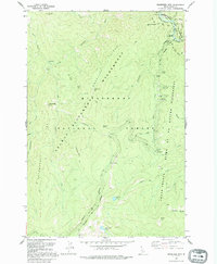
1991 Map of Magruder Mountain
USGS Topo · Published 1995About this map
The Magruder Massacre Site serves as a stark historical marker along the upper Selway River, where the Nez Perce Trail traverses the high ridges of the Bitterroot range. This 1991 photo-inspected map details a remote landscape where the Bitterroot National Forest meets the massive Selway-Bitterroot Wilderness and the Frank Church-River of No Return Wilderness. The geography is defined by steep drainage systems like Salamander Creek and Little Clearwater River, punctuated by high points such as Magruder Mtn and Deadtop Mtn. The infrastructure is limited to primitive camping at Magruder Campground and a network of pack trails, including the Indian Trail, which follow the difficult terrain of Magruder Ridge and Salamander Ridge. Higher elevation features include Gold Pan Lake and Elk Track Lakes, reflecting the alpine character of this central Idaho interior.
Find a feature on this map
45 named features on this map. Tap any name to fly to it.
Don’t see what you’re looking for? This feature index may not catch every label — zoom into the map to look around manually.
Map Details
Editions of this 1991 Magruder Mountain Map
This is the sole edition of this map. No revisions or reprints were ever made.
Other maps of this area

1956 · Elk City
USGS Topo · 1:250,000

1960 · Elk City
USGS Topo · 1:250,000

1962 · Wood Hump
USGS Topo · 1:24,000

1962 · Beaver Jack Mtn
USGS Topo · 1:24,000

1966 · Spot Mountain
USGS Topo · 1:24,000

1966 · Three Prong Mountain
USGS Topo · 1:24,000
1966 · Burnt Strip Mtn
USGS Topo · 1:24,000

1978 · Dennis Mtn
USGS Topo · 1:24,000

1978 · Magruder Mtn
USGS Topo · 1:24,000
1979 · Sabe Mtn
USGS Topo · 1:24,000