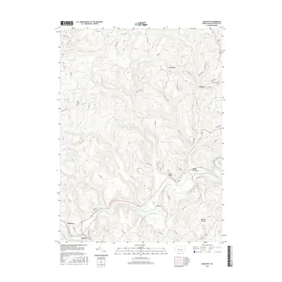
2016 Map of Mahaffey
USGS Topo · Published 2016About this map
Mahaffey and its neighboring hamlets follow the winding path of the West Branch Susquehanna River as it cuts through the high plateaus of Clearfield County. This 2016 survey shows the river’s dominance over the local geography, anchoring small clusters of settlement such as Bower and Middleton along the southern banks. The map reveals a landscape defined by its transition from river-bottom communities to higher ridges, where names like Irishtown and Walltown mark long-established upland homesteads.
Find a feature on this map
67 named features on this map. Tap any name to fly to it.
Don’t see what you’re looking for? This feature index may not catch every label — zoom into the map to look around manually.
Map Details
Editions of this 2016 Mahaffey Map
This is the sole edition of this map. No revisions or reprints were ever made.
Other maps of this area

1903 · Curwensville
USGS Topo · 1:62,500

1906 · Punxsutawney
USGS Topo · 1:62,500

1922 · Du Bois
USGS Topo · 1:62,500

1924 · Du Bois
USGS Topo · 1:62,500

1929 · Penfield
USGS Topo · 1:62,500

1932 · Penfield
USGS Topo · 1:62,500

1939 · Curwensville
USGS Topo · 1:62,500

1939 · Punxsutawney
USGS Topo · 1:62,500

1942 · Curwensville
USGS Topo · 1:62,500

1942 · Punxsutawney
USGS Topo · 1:62,500
Featured Places
- Bloom Township, PA
- Bower, Greenwood Township
- Middleton, Bell Township
- Brady Township, PA
- Greenwood Township, PA