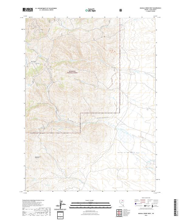
2021 Map of Mahala Creek West
USGS Topo · Published 2021About this map
The Independence Mountains dominate this high-desert landscape within the Humboldt National Forest, where steep canyons and seasonal water sources define the geography of northeastern Nevada. This 2021 survey documents a region reliant on scattered water points such as Spaghetti Spring, Italian Spring, and Warm Springs, which have long served as vital stops for those navigating the arid terrain. The map details the transition from the high ridges down into the Valley of the North Fork to the southeast.
Find a feature on this map
36 named features on this map. Tap any name to fly to it.
Don’t see what you’re looking for? This feature index may not catch every label — zoom into the map to look around manually.
Map Details
Editions of this 2021 Mahala Creek West Map
This is the sole edition of this map. No revisions or reprints were ever made.
Other maps of this area

1955 · McDermitt
USGS Topo · 1:250,000

1955 · Wells
USGS Topo · 1:250,000

1956 · Tuscarora
USGS Topo · 1:62,500

1958 · Wells
USGS Topo · 1:250,000

1959 · McDermitt
USGS Topo · 1:250,000

1961 · Wells
USGS Topo · 1:250,000

1970 · Stampede Ranch
USGS Topo · 1:24,000

1971 · Mahala Creek West
USGS Topo · 1:24,000

1971 · North Fork
USGS Topo · 1:24,000

1971 · California Mtn.
USGS Topo · 1:24,000