
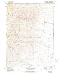
1971 Map of Mahala Creek West
USGS Topo · Published 1974About this map
The eastern slopes of the Independence Mountains define this section of the Humboldt National Forest in northern Nevada. The landscape is marked by a complex network of canyons and high basins, including Road Canyon, Spaghetti Canyon, and the sprawling Burns Basin. In this arid terrain, water sources are essential, as evidenced by the numerous named springs like Van Wyper Spring, Pattani Spring, and Italian Spring that dot the map.
Find a feature on this map
29 named features on this map. Tap any name to fly to it.
Don’t see what you’re looking for? This feature index may not catch every label — zoom into the map to look around manually.
Map Details
Editions of this 1971 Mahala Creek West Map
2 editions found
Other maps of this area

1955 · McDermitt
USGS Topo · 1:250,000

1955 · Wells
USGS Topo · 1:250,000

1956 · Tuscarora
USGS Topo · 1:62,500

1958 · Wells
USGS Topo · 1:250,000

1959 · McDermitt
USGS Topo · 1:250,000

1961 · Wells
USGS Topo · 1:250,000

1970 · Stampede Ranch
USGS Topo · 1:24,000

1971 · North Fork
USGS Topo · 1:24,000

1971 · California Mtn.
USGS Topo · 1:24,000
1971 · Wieland Flat
USGS Topo · 1:24,000