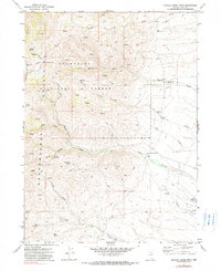
1971 Map of Mahala Creek West
USGS Topo · Published 1980About this map
Humboldt National Forest and the Independence Mountains dominate this high-desert ranching landscape in northern Nevada. The survey details the vital water management systems of the era, centered around the Saval Ranch and its supporting infrastructure like Saval Reservoir and Ross Reservoir. The network of seasonal drainages including Pie Creek, Mahala Creek, and Gance Creek are punctuated by numerous groundwater sources, such as Warm Springs, Van Wyper Spring, and Italian Spring. This region's utility for livestock and local industry is evident through the scattered Prospect markers and the Jeep trails that navigate between the Jim Hills and Spaghetti Canyon. The map preserves a moment when remote Nevada ranching relied on these specific springs and canyons before later land-use changes.
Find a feature on this map
25 named features on this map. Tap any name to fly to it.
Don’t see what you’re looking for? This feature index may not catch every label — zoom into the map to look around manually.
Map Details
Editions of this 1971 Mahala Creek West Map
2 editions found
Other maps of this area

1955 · McDermitt
USGS Topo · 1:250,000

1955 · Wells
USGS Topo · 1:250,000

1956 · Tuscarora
USGS Topo · 1:62,500

1958 · Wells
USGS Topo · 1:250,000

1959 · McDermitt
USGS Topo · 1:250,000

1961 · Wells
USGS Topo · 1:250,000

1970 · Stampede Ranch
USGS Topo · 1:24,000

1971 · Mahala Creek West
USGS Topo · 1:24,000

1971 · North Fork
USGS Topo · 1:24,000

1971 · California Mtn.
USGS Topo · 1:24,000