
1971 Map of California Mtn.
USGS Topo · Published 1974About this map
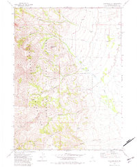
Independence Mountains dominate this high-elevation terrain in Elko County, where the eastern slopes of the range drop into a network of drainages during the early 1970s. The landscape is defined by the headwaters of several systems, including North Fork Pratt Creek and Foreman Creek, which flow through the protected lands of the Humboldt National Forest. Isolated ranching outposts such as Evans Ranch and Jose Ranch anchor the lower elevations to the east, while the western side of the quadrangle is marked by the steep ascent toward Independence Mountain. A complex system of jeep trails provides the only access to remote landmarks like Deadmans Spring and the Winters area, illustrating the difficult seasonal movement required in this part of Nevada. The presence of California Mountain and the deep cut of Jerritt Canyon further underscore the varied topography of this ranching and forest landscape.
Find a feature on this map
23 named features on this map. Tap any name to fly to it.
Don’t see what you’re looking for? This feature index may not catch every label — zoom into the map to look around manually.
Map Details
Editions of this 1971 California Mtn. Map
3 editions found
Other maps of this area

1955 · McDermitt
USGS Topo · 1:250,000

1955 · Wells
USGS Topo · 1:250,000

1956 · Tuscarora
USGS Topo · 1:62,500

1956 · Bull Run
USGS Topo · 1:62,500

1956 · Wild Horse
USGS Topo · 1:62,500

1958 · Wells
USGS Topo · 1:250,000

1959 · McDermitt
USGS Topo · 1:250,000

1961 · Wells
USGS Topo · 1:250,000

1971 · Mahala Creek West
USGS Topo · 1:24,000

1971 · North Fork
USGS Topo · 1:24,000