
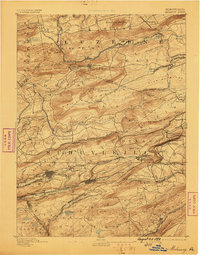
1892 Map of Mahanoy
USGS Topo · Published 1892About this map
Mahanoy City and Shenandoah anchor this late nineteenth-century portrait of the Pennsylvania anthracite region, where a dense lattice of industrial rail lines navigates the ridges of the Coal Region. The landscape is defined by the convergence of major carriers including the Pennsylvania Railroad, the Lehigh Valley Railroad, and the Philadelphia and Reading Railroad. This infrastructure connects mountain-bound settlements like Audenried and Delano to the broader regional economy, following the paths of Catawissa Creek and Black Creek.
Find a feature on this map
98 named features on this map. Tap any name to fly to it.
Don’t see what you’re looking for? This feature index may not catch every label — zoom into the map to look around manually.
Map Details
Editions of this 1892 Mahanoy Map
This is the sole edition of this map. No revisions or reprints were ever made.
Other maps of this area

1889 · Catawissa
USGS Topo · 1:62,500

1889 · Hazleton
USGS Topo · 1:62,500

1889 · Pottsville
USGS Topo · 1:62,500

1891 · Wilkesbarre
USGS Topo · 1:62,500

1891 · Hazleton
USGS Topo · 1:62,500

1891 · Pottsville
USGS Topo · 1:62,500

1892 · Catawissa
USGS Topo · 1:62,500

1892 · Pine Grove
USGS Topo · 1:62,500

1893 · Hazleton
USGS Topo · 1:62,500
1893 · Mahanoy
USGS Topo · 1:62,500