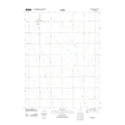
2012 Map of Mahaska
USGS Topo · Published 2012About this map
Mahaska sits at the northern edge of this Kansas landscape, a town defined by a tight grid of streets including S Main St, S Pine St, and Charles St. The surrounding countryside in Washington County follows a strict section-line road system, with routes like Arrowhead Rd and Bismark Rd cutting through the agricultural terrain. The drainage of the land is shaped by the southward flow of Myer Cr and Bowman Cr, which are joined by smaller tributaries such as Stanley Br and Gray Br. Genealogists will find the area's history anchored by the Mahaska Cem located just east of the main settlement and the more isolated Larabee Cem situated further south along Eagle Rd. The map illustrates a rural environment where local life is centered on the small township and its connection to the surrounding farmland.
Find a feature on this map
35 named features on this map. Tap any name to fly to it.
Don’t see what you’re looking for? This feature index may not catch every label — zoom into the map to look around manually.
Map Details
Editions of this 2012 Mahaska Map
This is the sole edition of this map. No revisions or reprints were ever made.
Other maps of this area

1893 · Washington
USGS Topo · 1:125,000

1955 · Manhattan
USGS Topo · 1:250,000

1955 · Lincoln
USGS Topo · 1:250,000

1956 · Manhattan
USGS Topo · 1:250,000

1957 · Manhattan
USGS Topo · 1:250,000

1957 · Lincoln
USGS Topo · 1:250,000

1958 · Lincoln
USGS Topo · 1:250,000

1960 · Fairbury SW
USGS Topo · 1:24,000

1960 · Reynolds
USGS Topo · 1:24,000

1960 · Hubbell
USGS Topo · 1:24,000