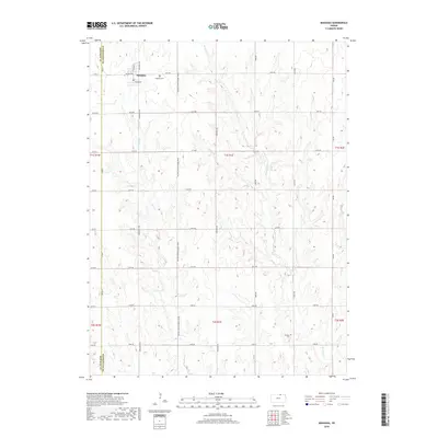
2018 Map of Mahaska
USGS Topo · Published 2018About this map
Mahaska sits at the northern edge of Washington County, Kansas, positioned just south of the Nebraska border. The town is structured around a network of local roads including N Main St, N School Ave, and William St, with the local Po and Mahaska Cem anchoring the community. The surrounding landscape is defined by the headwaters of several drainages, where Bowman Cr, Stanley Br, and Myer Cr carve subtle valleys through the agricultural sections. To the southeast, the Larabee Cem serves as a remote landmark near Gray Br. This 2018 survey illustrates the persistent rural character of the region, where a dense grid of gravel roads like the FAS 658 (County Gravel Road) connects isolated homesteads and farmland across the Republic and Washington County lines.
Find a feature on this map
41 named features on this map. Tap any name to fly to it.
Don’t see what you’re looking for? This feature index may not catch every label — zoom into the map to look around manually.
Map Details
Editions of this 2018 Mahaska Map
This is the sole edition of this map. No revisions or reprints were ever made.
Other maps of this area

1893 · Washington
USGS Topo · 1:125,000

1955 · Manhattan
USGS Topo · 1:250,000

1955 · Lincoln
USGS Topo · 1:250,000

1956 · Manhattan
USGS Topo · 1:250,000

1957 · Manhattan
USGS Topo · 1:250,000

1957 · Lincoln
USGS Topo · 1:250,000

1958 · Lincoln
USGS Topo · 1:250,000

1960 · Fairbury SW
USGS Topo · 1:24,000

1960 · Reynolds
USGS Topo · 1:24,000

1960 · Hubbell
USGS Topo · 1:24,000