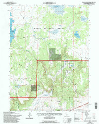
1993 Map of Mahogany Ridge
USGS Topo · Published 1996About this map
The Modoc National Forest dominates this landscape in northeastern California, where complex water management systems define the terrain. High-elevation water storage is central to the area's layout, anchored by the Big Sage Reservoir to the west and the Raker and Thomas Reservoirs along the northern boundary. Smaller impoundments like Emigrant Spring Reservoir and Wood Flat Reservoir are scattered across the forest, connected by a network of seasonal drainages including Rattlesnake Creek.
Find a feature on this map
29 named features on this map. Tap any name to fly to it.
Don’t see what you’re looking for? This feature index may not catch every label — zoom into the map to look around manually.
Map Details
Editions of this 1993 Mahogany Ridge Map
This is the sole edition of this map. No revisions or reprints were ever made.
Other maps of this area

1886 · Alturas
USGS Topo · 1:250,000

1892 · Alturas
USGS Topo · 1:250,000

1954 · Alturas
USGS Topo · 1:250,000

1958 · Alturas
USGS Topo · 1:250,000

1961 · Alturas
USGS Topo · 1:62,500

1962 · Alturas
USGS Topo · 1:250,000

1962 · Davis Creek
USGS Topo · 1:62,500

1962 · Big Sage Reservoir
USGS Topo · 1:62,500

1963 · Dorris Reservoir
USGS Topo · 1:24,000

1965 · Alturas
USGS Topo · 1:250,000