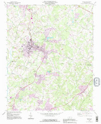
1993 Map of Maiden
USGS Topo · Published 1996About this map
Maiden serves as a regional center of industry and transportation along the Southern railroad line during the mid-1990s. The town's manufacturing character is evident at the Providence Mill and the nearby Filtration Plant, while its civic life is anchored by several long-standing congregations, including St James Ch and Maiden Chapel. To the north, a State Prison Camp and a large Pumping Sta are located near the headwaters of Bills Branch.
Find a feature on this map
51 named features on this map. Tap any name to fly to it.
Don’t see what you’re looking for? This feature index may not catch every label — zoom into the map to look around manually.
Map Details
Editions of this 1993 Maiden Map
2 editions found
Other maps of this area

1895 · Hickory
USGS Topo · 1:125,000

1909 · Lincolnton
USGS Topo · 1:62,500

1911 · Lincolnton
USGS Topo · 1:62,500

1914 · Gastonia
USGS Topo · 1:48,000

1916 · Gastonia
USGS Topo · 1:62,500

1953 · Charlotte
USGS Topo · 1:250,000

1954 · Charlotte
USGS Topo · 1:250,000

1960 · Charlotte
USGS Topo · 1:250,000

1962 · Charlotte
USGS Topo · 1:250,000
1970 · Lincolnton East
USGS Topo · 1:24,000