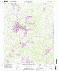
1993 Map of Maiden
USGS Topo · Published 1996About this map
The town of Maiden serves as the central hub of this 1990s survey, straddling the boundary between Catawba Co and Lincoln Co. This period of the town's development is marked by significant infrastructure, including a Sewage Disposal facility and a large Filtration Plant near Providence Mill. The industrial and civic footprint extends to the north with a State Prison Camp and Pumping Sta located near Duan.
Find a feature on this map
55 named features on this map. Tap any name to fly to it.
Don’t see what you’re looking for? This feature index may not catch every label — zoom into the map to look around manually.
Map Details
Editions of this 1993 Maiden Map
2 editions found
Other maps of this area

1895 · Hickory
USGS Topo · 1:125,000

1909 · Lincolnton
USGS Topo · 1:62,500

1911 · Lincolnton
USGS Topo · 1:62,500

1914 · Gastonia
USGS Topo · 1:48,000

1916 · Gastonia
USGS Topo · 1:62,500

1953 · Charlotte
USGS Topo · 1:250,000

1954 · Charlotte
USGS Topo · 1:250,000

1960 · Charlotte
USGS Topo · 1:250,000

1962 · Charlotte
USGS Topo · 1:250,000
1970 · Lincolnton East
USGS Topo · 1:24,000