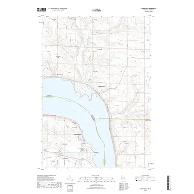
2018 Map of Maiden Rock
USGS Topo · Published 2018About this map
Lake Pepin dominates this landscape, serving as a wide natural expansion of the Mississippi River that defines the border between Wisconsin and Minnesota. The Wisconsin side is characterized by steep bluffs and deep coulees, including Bremennington Coulee and Morgan Coulee, where small settlements like Maiden Rock and Warrentown sit at the base of dramatic ridges. Across the water in Minnesota, the village of Old Frontenac and nearby Frontenac occupy a more gradual slope leading to Garrard Bluff and the prominent Point-no-Point.
Find a feature on this map
108 named features on this map. Tap any name to fly to it.
Don’t see what you’re looking for? This feature index may not catch every label — zoom into the map to look around manually.
Map Details
Editions of this 2018 Maiden Rock Map
This is the sole edition of this map. No revisions or reprints were ever made.
Other maps of this area

1932 · Wabasha
USGS Topo · 1:62,500

1935 · Arkansaw
USGS Topo · 1:48,000

1940 · Maiden Rock
USGS Topo · 1:62,500

1941 · Arkansaw
USGS Topo · 1:62,500

1942 · Arkansaw
USGS Topo · 1:62,500

1950 · Maiden Rock
USGS Topo · 1:62,500

1951 · Wabasha
USGS Topo · 1:62,500

1951 · Lake City
USGS Topo · 1:62,500

1953 · Saint Paul
USGS Topo · 1:250,000

1959 · Saint Paul
USGS Topo · 1:250,000