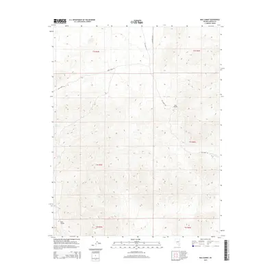
2015 Map of Mail Summit
USGS Topo · Published 2015About this map
Mail Summit stands as the central topographic landmark in this high-elevation stretch of Lincoln County, where the desert landscape is defined by its drainage systems and mountain passes. The map documents a sparse network of unpaved routes, most notably Mail Summit Rd and Jackrabbit Pass Rd, which provide access through the complex terrain. These corridors follow natural contours, connecting isolated water sources such as Henry Spring and Springer Spring. The presence of Silver Canyon in the southwestern quadrant suggests a history of erosion and passage through the uplifted ridges. This 2015 survey reflects a remote interior where human infrastructure is limited to essential ranching or transit tracks, maintaining the character of the Great Basin wilderness.
Find a feature on this map
13 named features on this map. Tap any name to fly to it.
Don’t see what you’re looking for? This feature index may not catch every label — zoom into the map to look around manually.
Map Details
Editions of this 2015 Mail Summit Map
This is the sole edition of this map. No revisions or reprints were ever made.
Other maps of this area

1954 · Caliente
USGS Topo · 1:250,000

1959 · Caliente
USGS Topo · 1:250,000

1970 · Seaman Wash
USGS Topo · 1:24,000

1970 · Fossil Peak
USGS Topo · 1:24,000

1970 · Hiko
USGS Topo · 1:24,000

1985 · Mail Summit
USGS Topo · 1:24,000
1985 · Mount Irish
USGS Topo · 1:24,000
1985 · Crescent Spring
USGS Topo · 1:24,000
1985 · Mount Irish SE
USGS Topo · 1:24,000

1985 · Murphy Gap
USGS Topo · 1:24,000