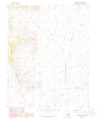
1985 Map of Mount Irish SE
USGS Topo · Published 1986About this map
Pahranagat Valley dominates the eastern half of this 1980s provisional survey, revealing a landscape defined by the sharp transition between the valley floor and the high elevations of the Mount Irish Range. In this arid interior drainage basin, water movement is recorded by features like Silver Canyon and Logan Creek, which cut through the western slopes. The map captures the infrastructure of the late twentieth century, showing a major Transmission Line traversing the southern portion of the valley alongside primitive 4wd tracks that provide the only access into the steeper canyon reaches. This document is particularly useful for understanding the exact placement of survey markers such as BM 4357 and BM 4058 during a period when these Great Basin landforms were being systematically documented for resource management.
Find a feature on this map
9 named features on this map. Tap any name to fly to it.
Don’t see what you’re looking for? This feature index may not catch every label — zoom into the map to look around manually.
Map Details
Editions of this 1985 Mount Irish SE Map
This is the sole edition of this map. No revisions or reprints were ever made.
Other maps of this area

1945 · Alamo
USGS Topo · 1:125,000

1954 · Caliente
USGS Topo · 1:250,000

1959 · Caliente
USGS Topo · 1:250,000

1969 · Ash Springs
USGS Topo · 1:24,000

1970 · Fossil Peak
USGS Topo · 1:24,000

1970 · Hiko
USGS Topo · 1:24,000
1983 · Crescent Reservoir
USGS Topo · 1:24,000
1983 · Hancock Summit
USGS Topo · 1:24,000

1985 · Pahranagat Range
USGS Topo · 1:100,000

1985 · Mail Summit
USGS Topo · 1:24,000