
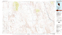
1985 Map of Pahranagat Range
USGS Topo · Published 1985About this map
Alamo serves as the primary hub of human settlement in this mid-1980s landscape, situated in the fertile Pahranagat Valley. This region is defined by a stark contrast between protected natural environments and restricted military zones. The Pahranagat National Wildlife Refuge and Desert National Wildlife Range preserve critical water sources like Upper Pahranagat Lake and Ash Springs. To the west, the map transitions into the highly restricted Nellis Air Force Range, where the dry beds of Groom Lake and Papoose Lake lie within the Military Reservation Boundary.
Find a feature on this map
84 named features on this map. Tap any name to fly to it.
Don’t see what you’re looking for? This feature index may not catch every label — zoom into the map to look around manually.
Map Details
Editions of this 1985 Pahranagat Range Map
2 editions found
Other maps of this area

1885 · Pioche
USGS Topo · 1:250,000

1886 · Saint Thomas
USGS Topo · 1:250,000

1886 · Pioche
USGS Topo · 1:250,000

1893 · Saint Thomas
USGS Topo · 1:250,000

1907 · Las Vegas
USGS Topo · 1:250,000

1908 · Kawich
USGS Topo · 1:250,000

1908 · Furnace Creek
USGS Topo · 1:250,000

1908 · Las Vegas
USGS Topo · 1:250,000

1910 · Furnace Creek
USGS Topo · 1:250,000

1942 · Emigrant Valley
USGS Topo · 1:125,000