
1970 Map of Fossil Peak
USGS Topo · Published 1973About this map
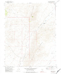
Pahranagat Valley and the surrounding high desert terrain are the primary focus of this 1970 survey, capturing a remote section of Lincoln County before modern developments. The geography is defined by the Seaman Range and the Hiko Range, which flank the central valley floor. Water management in this arid environment is evident through several mapped wells, including Well 4022 and Well 3948, along with the John Wright Reservoir situated near the Hiko Narrows. The White River winds through the eastern portion of the quadrangle, while the presence of a Drill Hole and various jeep trails suggest localized exploration and land use in the vast Sixmile Flat region. Rising prominently over the landscape is Fossil Peak, a significant topographic landmark for the area.
Find a feature on this map
18 named features on this map. Tap any name to fly to it.
Don’t see what you’re looking for? This feature index may not catch every label — zoom into the map to look around manually.
Map Details
Editions of this 1970 Fossil Peak Map
2 editions found
Other maps of this area

1954 · Caliente
USGS Topo · 1:250,000

1959 · Caliente
USGS Topo · 1:250,000

1970 · Hiko NE
USGS Topo · 1:24,000

1970 · Hiko SE
USGS Topo · 1:24,000

1970 · Seaman Wash
USGS Topo · 1:24,000
1970 · White River Narrows
USGS Topo · 1:24,000

1970 · Hiko
USGS Topo · 1:24,000

1985 · Mail Summit
USGS Topo · 1:24,000
1985 · Mount Irish SE
USGS Topo · 1:24,000
1985 · Murphy Gap SE
USGS Topo · 1:24,000