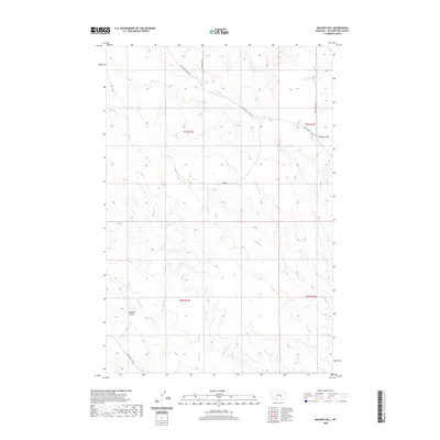
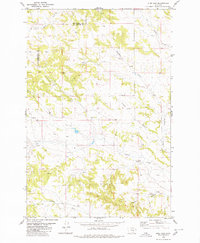
2020 Map of Mailbox Hill
USGS Topo · Published 2020About this map
Mail Box Hill rises as a prominent landmark in this segment of Yellowstone County, providing a high vantage point over a landscape defined by seasonal drainages and early transit routes. The presence of Musselshell Trail Rd and Melstone Rd highlights the historic movement of people and livestock through these plains, following natural corridors between the Musselshell and Yellowstone watersheds. This area is etched by numerous coulees and creek beds, including the northern reaches of Buffalo Cr and its eastern fork, E Buffalo Cr. To the southwest, Kendall Coulee and Deadman Cr reveal the rugged erosion patterns typical of the region. The map also documents the local road network, such as Custer Pineview Rd and Trower, which serve the dispersed agricultural interests of this open ranching country.
Find a feature on this map
14 named features on this map. Tap any name to fly to it.
Don’t see what you’re looking for? This feature index may not catch every label — zoom into the map to look around manually.
Map Details
Editions of this 2020 Mailbox Hill Map
This is the sole edition of this map. No revisions or reprints were ever made.
Other maps of this area

1954 · Forsyth
USGS Topo · 1:250,000

1957 · Forsyth
USGS Topo · 1:250,000

1958 · Forsyth
USGS Topo · 1:250,000

1960 · Coal Bank Creek
USGS Topo · 1:24,000

1979 · Hysham
USGS Topo · 1:100,000

1980 · Mud Butte
USGS Topo · 1:24,000
1980 · Bull Mountain NW
USGS Topo · 1:24,000
1980 · Weed Creek West
USGS Topo · 1:24,000
1980 · Weed Creek East
USGS Topo · 1:24,000
1980 · Pine View
USGS Topo · 1:24,000