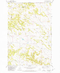
1980 Map of Pine View
USGS Topo · Published 1980About this map
Pine View and the surrounding high plains along the Musselshell Co Yellowstone Co line appear here as they were documented in the 1970s. The landscape is defined by its drainage systems, including Hawk Creek in the northwest and Deadman Creek winding through the eastern sections. Small-scale resource development is evident through the numerous Wells scattered across the township, particularly near Donalds Spring and the Coulee systems.
Find a feature on this map
13 named features on this map. Tap any name to fly to it.
Don’t see what you’re looking for? This feature index may not catch every label — zoom into the map to look around manually.
Map Details
Editions of this 1980 Pine View Map
This is the sole edition of this map. No revisions or reprints were ever made.
Other maps of this area

1954 · Forsyth
USGS Topo · 1:250,000

1954 · Roundup
USGS Topo · 1:250,000

1957 · Forsyth
USGS Topo · 1:250,000

1958 · Roundup
USGS Topo · 1:250,000

1958 · Forsyth
USGS Topo · 1:250,000

1979 · Roundup
USGS Topo · 1:100,000

1979 · Corey Flat
USGS Topo · 1:24,000

1979 · Hysham
USGS Topo · 1:100,000

1980 · Mud Butte
USGS Topo · 1:24,000
1980 · P K Ranch NE
USGS Topo · 1:24,000