
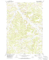
1979 Map of Corey Flat
USGS Topo · Published 1979About this map
Corey Flat dominates this high-plains landscape in Musselshell County during the late 1970s. This survey reveals a terrain defined by its water management and resource extraction, where numerous industrial and agricultural markers dot the valleys of Hawk Creek and Fishel Creek. The land is networked with specific borehole and well types, including a Flowing Well, the Tripod Well, and the Page Well, suggesting a reliance on subsurface aquifers for both ranching and localized mining activities. Local history and genealogy are centered near the northern boundary at the Musselshell Cem, while clusters labeled simply as Mines indicate the area's geological value. The map illustrates a rural Montana economy transitioning through the post-war era, with infrastructure like a Drill Hole pointing to energy or mineral exploration occurring alongside traditional land use.
Find a feature on this map
12 named features on this map. Tap any name to fly to it.
Don’t see what you’re looking for? This feature index may not catch every label — zoom into the map to look around manually.
Map Details
Editions of this 1979 Corey Flat Map
2 editions found
Other maps of this area

1954 · Forsyth
USGS Topo · 1:250,000

1954 · Roundup
USGS Topo · 1:250,000

1957 · Forsyth
USGS Topo · 1:250,000

1958 · Roundup
USGS Topo · 1:250,000

1958 · Forsyth
USGS Topo · 1:250,000

1962 · Queens Point
USGS Topo · 1:24,000

1963 · Musselshell
USGS Topo · 1:24,000

1963 · Delphia
USGS Topo · 1:24,000

1979 · Roundup
USGS Topo · 1:100,000

1979 · Melstone
USGS Topo · 1:100,000